Mount Alexander, granodiorite quarry. Two types of xenolith (xenolith and autolith) in granodiorite.
Linex Pty Ltd
Rocks around Bendigo - Heathcote region
A location map will be added to this page.
Last updated 22/6/03
| Field trip areas: | Bendigo to Heathcote (Axedale, Lake
Eppalock) Areas north and east of Heathcote (Lady's Pass, Mt Ida, Heathcote-Costerfield Rd) Heathcote township Tooborac-Puckapunyal Rd |
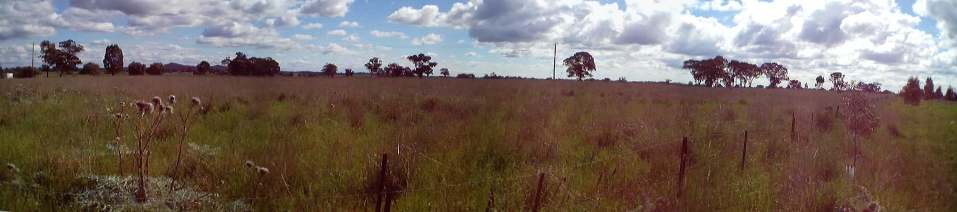
| Axedale, flat landscape resulting from an basaltic lava flow | |
| Mount Alexander, granodiorite quarry. Two types of xenolith (xenolith and autolith) in granodiorite. |
|
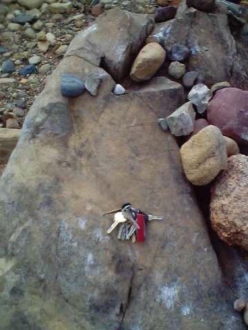
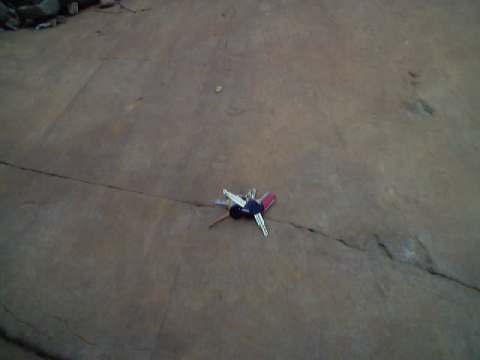
| Lake Eppalock, Knowsley. Variety of clasts from within Permian glacials. Clasts include granite, basalt, rhyolite, sandstone, shale and reef quartz in addition to the large striated boulder on which the keys rest. | |
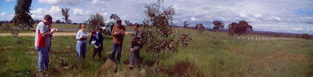
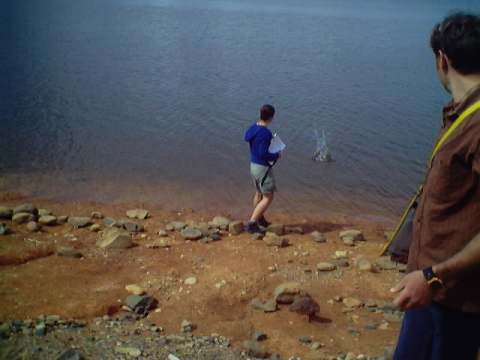
| Lake Eppalock, Knowsley. First year geology students (2001) "measuring" the particle size ranges in Permian glacials by the distance they can be thrown | |
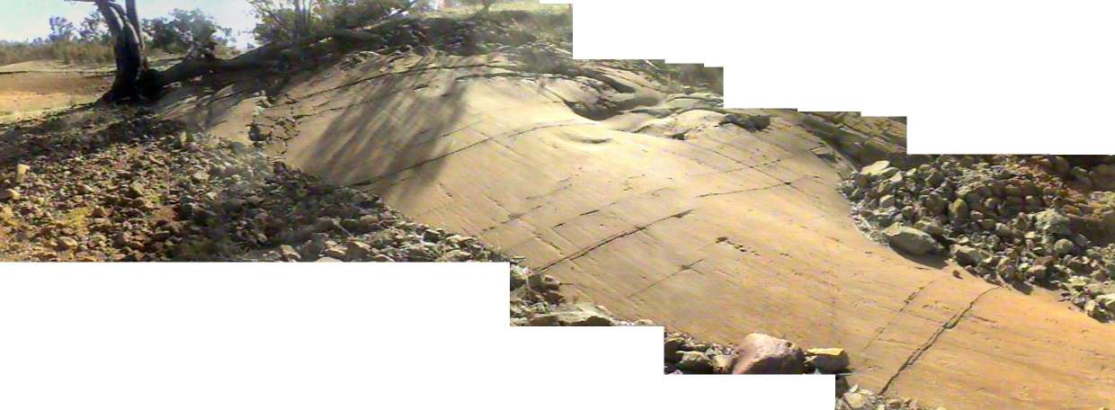
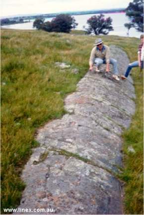
| Lake Eppalock, Knowsley. Kellam's rock, a glacial pavement of Ordovician sandstone that was scratched and gouged by debris laden ice during the Permian. | |
| Lake Eppalock, Knowsley. Two directions of striations on Kellam's rock. |
|
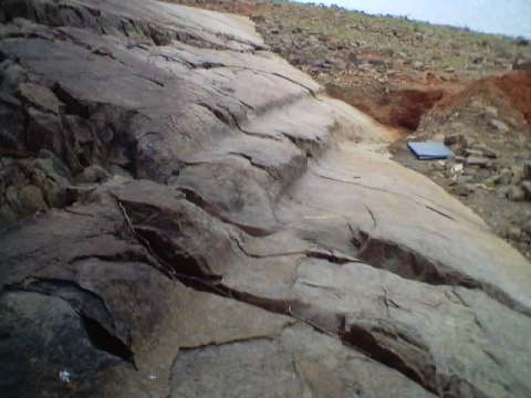
| Lake Eppalock, Knowsley. Deep grooves gouged into Kellam's rock. | |
| Lake Eppalock, Knowsley. Dunn's rock, glacial pavement. | |
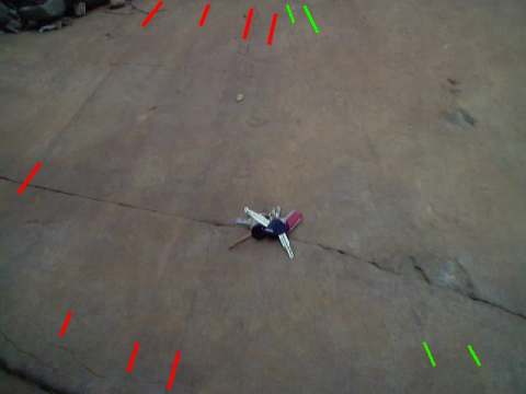
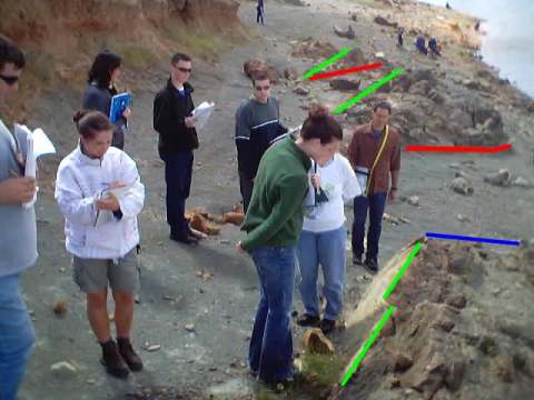
| Lake Eppalock, Moorabee point. Fluvioglacial channels. The top of the channels are indicated in green, the base of the channels are red. Blue is a later eroded edge to an existing channel. The oldest channel is a the bottom of the photo and the youngest towards the top. | |
| Lake Eppalock, McIvor Highway. "The Stanger", a 100 tonne erratic - boulder transported by Permian Glacials. | |
Areas north and east of Heathcote
| Lady's Pass, folded chert | 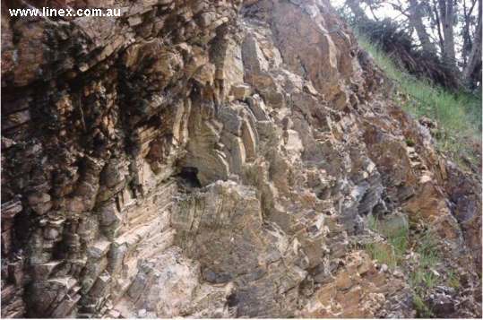 |
| Mt Ida, north of Heathcote. Quartz rich sandstone containing broken fragments of small, round fossils - the stems of Crinoids. The broken fossils and the uniform gran size in the sandstones indicate the rock formed in a marginal marine (beach) environment. The high percentage of quartz is the reason why Mt Ida is a ridge resitant ro erosion. | 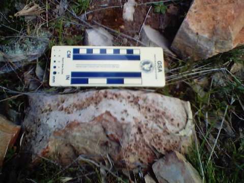 |
| View north from the Mt Ida fire tower. The fire tower is on a ridge of resistant sandstone. The walk form the car park to the fire tower is towards the west. However, the road to the car park climbs the north-south aligned ridge shown in the photo. The ridges changes orientaiton at the car park, which lies in the linge of a large syncline. | 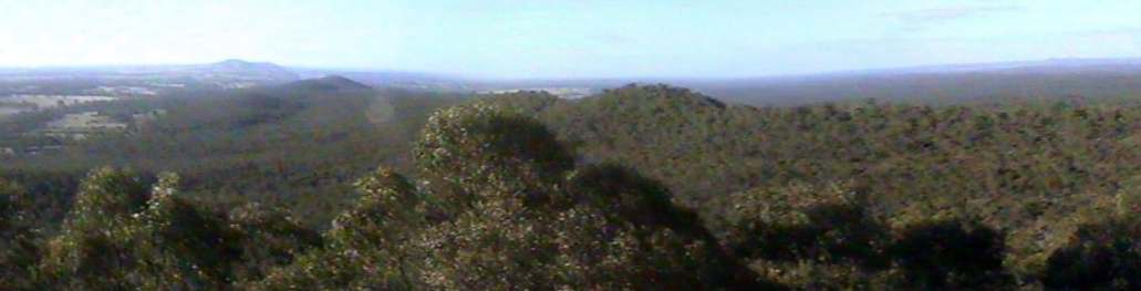 |
| Heathcote-Costerfield Rd. W-shaped fold cosnsiting of a syncline with a parasitic anticline in the hinge. This syncline is part of the same fold that passes through the car park near the summit of Mt Ida. | 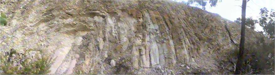 |
| Heathcote-Costerfield Rd. Boudins in the hinge of the above syncline. These feature form when the beds are stretched around the fold. The orientation of the boudins can be measured and depict the orientation of the fold. | 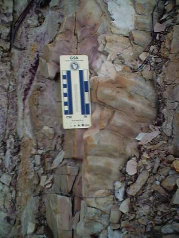  |
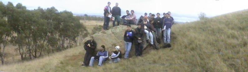
| Heathcote-Costerfield Rd. Third year structural geology students from the last ever third year class in Geology at La Trobe University Bendigo. The students are measuring the orientation of beds to plot on special graphs used by Geologists that describe the orientation of folds. | 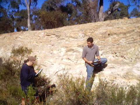 |
| Heathcote-Costerfield Rd. Traces of worms burrowing into the bedding surface. | 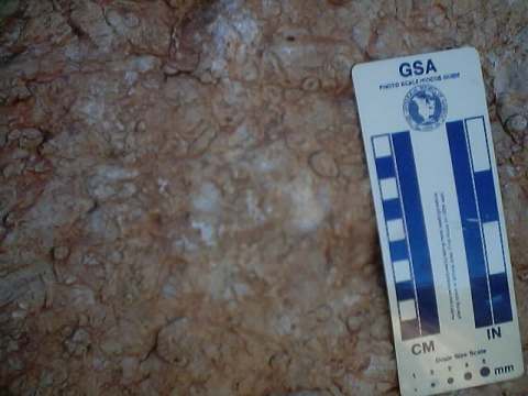 |
| Heathcote-Costerfield Rd. A differing example of burrows. | 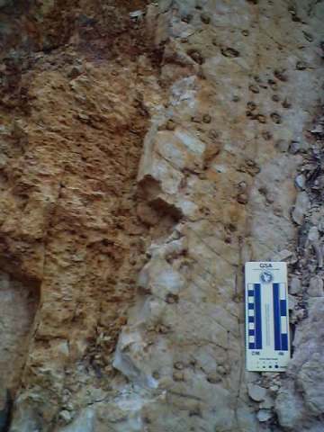 |
| Heathcote-Costerfield Rd. Load casts created during the deposition of the rocks and formed by the dewatering of sediments under the weight of additional deposits dumped over the top. | 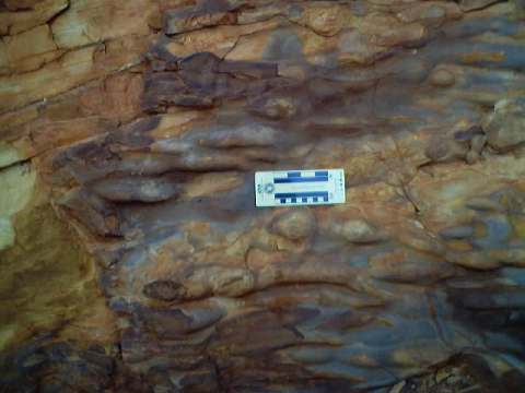 |
| Heathcote-Costerfield Rd. Two ball and pillow dewatering structures. The left on is showing a side view and the one of the right is cut through the middle. | 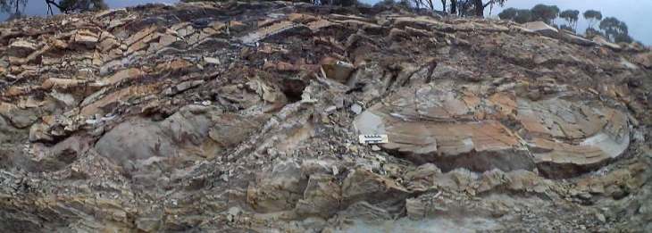 |
| Heathcote-Costerfield Rd. Large dewatering structures (tilted on it's side due to folding) - sand is injected through a small neck (in red) into the overlying sediments. | 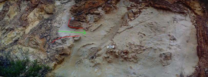 |
| Heathcote-Costerfield Rd. Early development of mud cracks. | 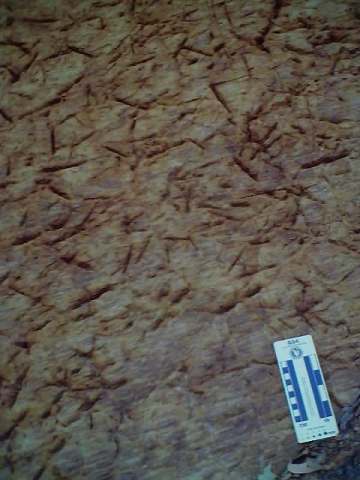 |
| Eroded Heathcote fault zone seprating Cambrian greenstones on the left (east) from Ordovician sandstones and shales on the right (west). | 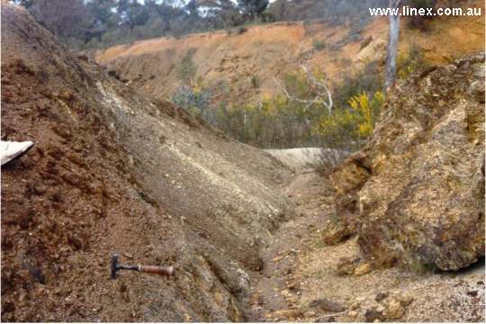 |
| Hird's open cut, Heathcote Fault zone. The open cut was operated in the 1990's and is the history of mining in the region. |  |
| Pink Cliffs, Heathcote. Weathered granodiorite plus one rounded, residual corestone of the original rock. These rocks were exposed after alluvial mining stripped back the overlying gravels in the search for gold. | 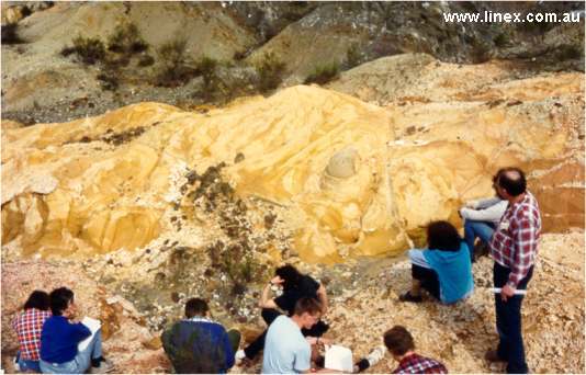 |
| Pink Cliffs, Heathcote. Unconformity between gold bearing gravels (above) and Ordovician turbidites below. | 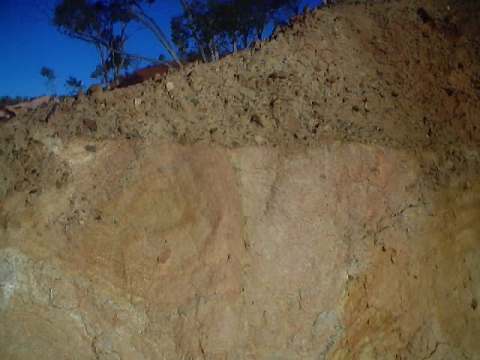 |
| Tooborac - Puckapunyal Road. Spectacular folding and faulting. | 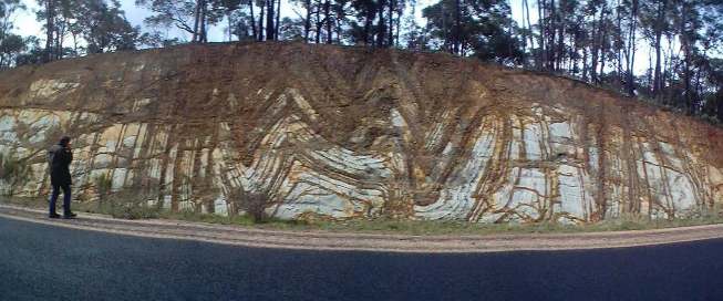 |
| Tooborac - Puckapunyal Road. Third year structural geology students, 2000, repeated in front of the cutting. | 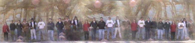 |
| Tooborac - Puckapunyal Road. Third year structural geology students, 2001, repeated in front of the cutting. | 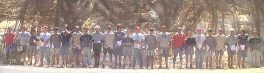 |
|
Page
created 21/06/02 |