Linex Pty Ltd
Rocks around Bendigo - Bendigo region
A location map will be added to this page.
Last updated 22/6/03
| Field trip areas: | Victoria Hill White Hills |
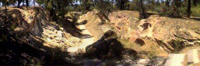
| Ballerstedt's open cut, view south. Hinge area of anticlinal fold. Beds of shale on the left of the picture dip to the east and beds of sandstone on the right of the picture dip east. The central part of the image shows where the hinge area has been mined to remove the gold bearing quartz. | |
| Ballerstedt's open cut, view north. Horizontal beds in the foreground occur in the hinge of the New Chum anticline. Sandstone beds dip east in the right of the photo. | |
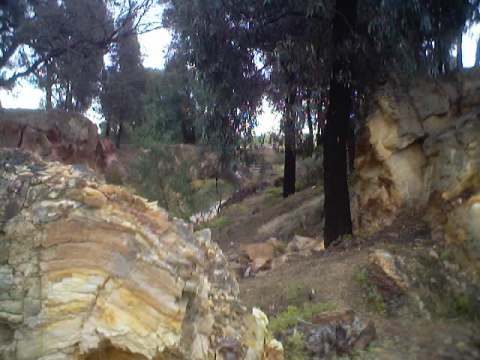
| Quartz veins (white and weathered to brown) in sandstone, Ballerstedt's open cut. | |
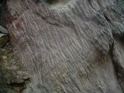
| Solution cleavage in sandstone on the west lim of the New Chum anticline in Ballerstendts open cut. Geologists use cleavage to assist to navigate their position with respect to the folds | |
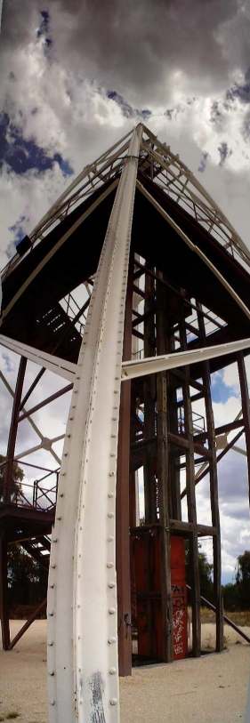
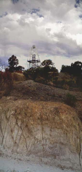
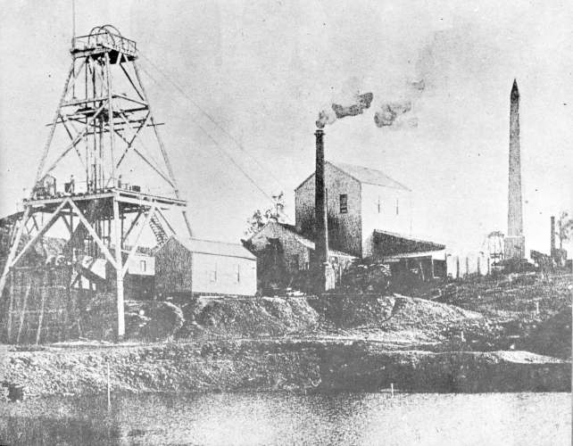
| Victoria Quartz headframe | |
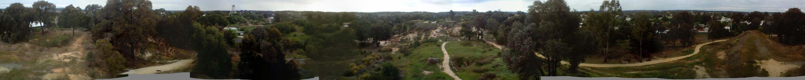
| 360 degree view from the top of the Victoria Quartz headframe | |
| 90 degree view north and east of Rae's open cut. | |
| New Chum Anticline, Rae's open cut, view south. A thin, vertical quartz vein (brown) marks the axis (centre) of the fold. Beds on either side dip east (left) and west (right) respectively. Some thin quartz veins occur along bedding and contain smaller, parasitic folds) | |
| View from the anticlinal fold in Rae's open cut towards the Victoria Quartz headframe | |
| Ripple marks in "Ripple bedded siltsone" (RBS) facies, Rae's open cut. | |
| View south of scoured medium grained sandstone into very fine grained sandstone indicating sediment transport direciton to the right of picture (east) | |
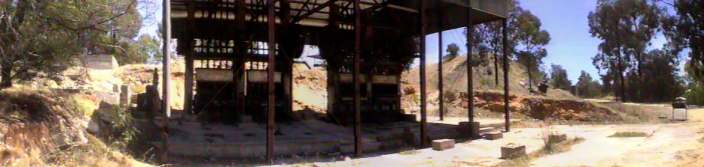
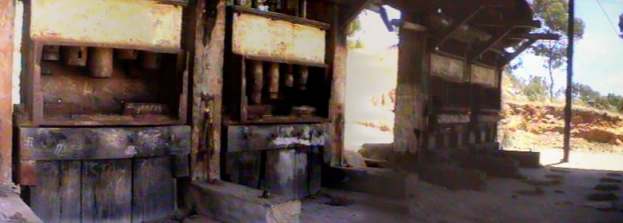
| Parts of a 20 head battery reconstructed for display. There are 4 banks of 5 stamping heads. The quartz with it's gold content (ore) was transported from the Victoria Quartz shaft via a tramway. The waste rock (mullock) remnants or the tramway is visible to the right of the shed. Concrete foundations to the left of the shed are where the steam engines were housed | |
| Close up of battery, showing the stamping heads. Ore is fed into the back of battery, it is crushed and then would pass over a series of sloping tables that assist to separate out the gold. The concrete remaining in frount of the battery shows there these tables stood. | |
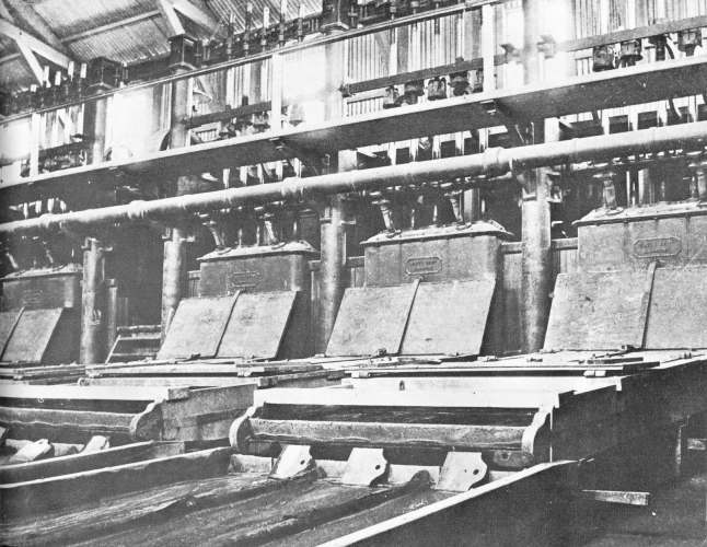
| An historic example of an operating battery (Palmer, 1975) | |
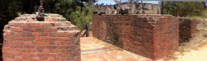
| Lansell's 180. Foundations of the winding engines used to haul water, men and quartz up the shaft. | |
| View south across the top of the winding foundations towards the position of the shaft itself, approximately 25 metres to the south. Adjacent to the part in the centre of the image, the earlier winding foundations are found that were used prior to George Lansell upgrading the infrastructure when deepening the mine. | |
| Lansell's 180 mine with the Victoria Quartz headframe in the background (Palmer, 1975). | |
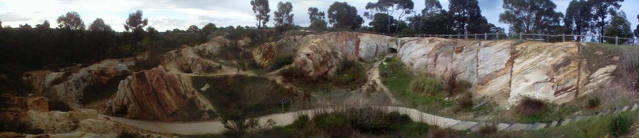
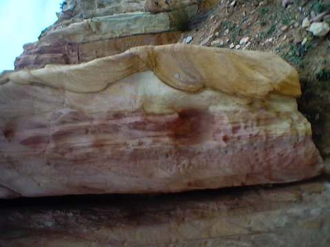
| White Hills gravel pit, view north. The pit is in conglomerate of reworked quartz pebbles from the Bendigo Quartz reefs transported by the ancient Bendigo Creek. The pit has been dug to the base of the gravels. The conglomerate is named the White Hills Gravels | 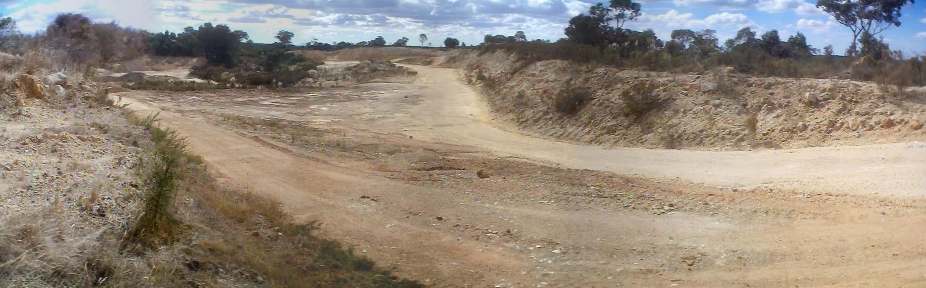 |
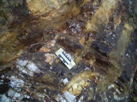
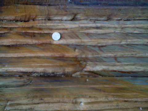
| An example of the White Hills Gravels showing quartz pebbles in a quartz/iron cement. This combines to make a very tough, resitant rock that is difficult to break down. As a result, the gravels that were formed in the valley in the ancient Bendigo Creek, now form part of a residual ridge. | 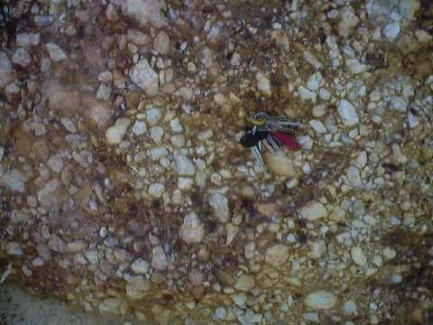 |
| The quartz particles in the White Hills Gravels reach up to one metre across | 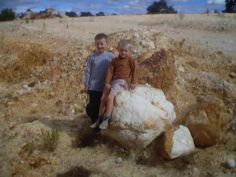 |
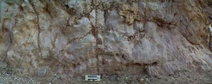
| Cross section through the ancient Bendigo Creek deposits. In the foreground the floow to the pit is the old creek bed, comprising Ordovician turbidites. The wall of the pit is a cross section through the gravels to their present exposure at the surface. | 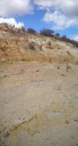 |
| Entrance to the White Hill Chinese diggings historical area. Here, miners sunk shafts into the White Hills gravels to mine alluvial gold | 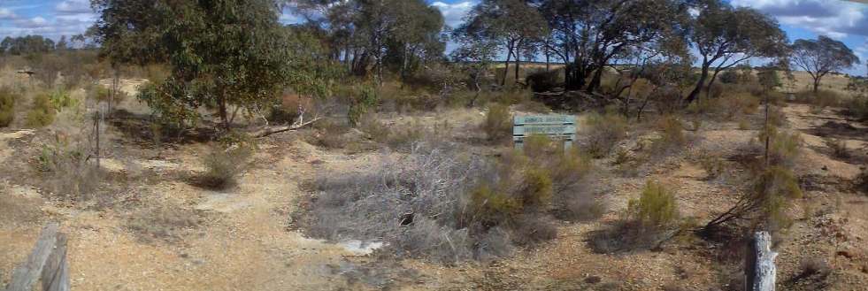 |
| White Hills Chinese diggings historical area. Characteristic round shaft sunk by Chinese miners. The Chinese believed that evil spirits lurked in the corners of shafts so therefore built sahfts without corners. | 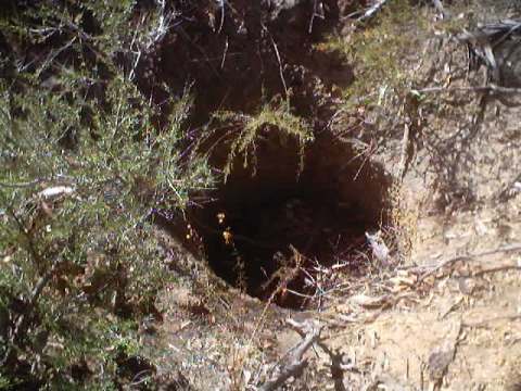 |
| White Hills Chinese diggings historical area. A rectangular shaft sunk by European miners. | 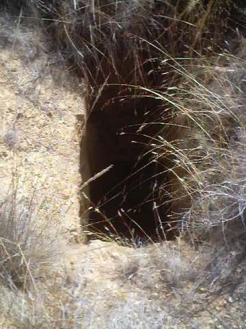 |
|
Page
created 19/06/03 |